
Geocaching on Papuk
Winter with its cloudy and cold days are behind us so it is time to go and do some geocaching, or just go out and periodically find some hidden box.
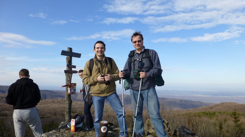
So we did just that and first day in March 2014 Zagy and me decided to go on a field-trip over peaks of Papuk. Main goals were to climb the 953m tall peak called Papuk, visit a few smaller peaks, to hide and to also find already placed geocaches. This time, from our team, on field-trip only I (Matko) was going while my wife Maja in the seventh month of pregnancy must pay attention to the small "boxer". ![]()
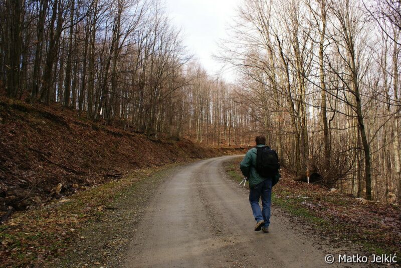
We left around 8:30 AM by car from Valpovo. Weather was finally a bit sunny and it overturned that winter depressing mood of the previous rainy days. Path to Papuk was known, and we were traveling towards the well-known picnic place Jankovac. However, on the dirt road we didn't turn to Jankovac, we went to pass called Anđina baraka. There we parked the car and we went hiking. ![]()
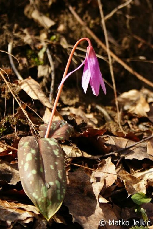
The climb to mountain peak Papuk wasn't so hard because all the way to the top you can follow the dirt road that ascends slowly. But because of the mild and meandering climb you still need about two hours to the top. But getting to the peak wasn't neither hard nor boring. It was sunny and relatively warm. We could finally take a deep breath of fresh mountain air, and enjoy birds singing and smelling mountain flowers by the road. Ofcourse that we stopped and took some pictures (picture & picture) of them.
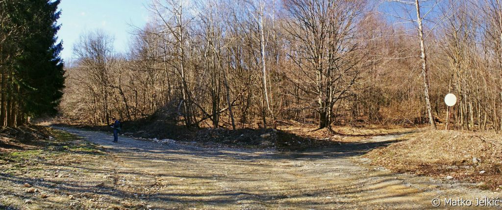
Zagy is well familiarized with climbing, and is also a member of mountaineering association, so he knew that it is most important to follow red and white markings that direct you to the right path. And markings have to be placed in the way that from one you must see the next marking and they have to be clearly visible along the way. But we wouldn't point that out but just because of those markings we got a bit lost. ![]() On the way we came to an intersection where we saw one marking, but not its second pair so we could just choose to go left or right. And of course, we went wrong, in our case, right.
On the way we came to an intersection where we saw one marking, but not its second pair so we could just choose to go left or right. And of course, we went wrong, in our case, right. ![]()
But, as you can see from the picture, the day was sunny and warm. Although we walked about 20 minutes longer to the top of Papuk, we weren't disappointed at all. On the way we took pictures of some other mountain flowers, so we are enriched by few more photographs. ![]()
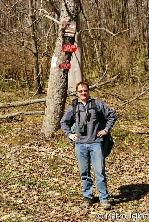
Now we went on the right path and there weren't any more crossings to miss ![]() so we found the right road sign and there wasn't any more doubt where we have to go. Going to the top, we found the sign that forbids photographing, because there is military facility on the top. We packed our cameras and for some time took no pictures, but we will describe everything through text. On the top, there was a young gentleman in military suit. At first we were concerned if we can approach to the fence at all, but the man wasn't that scary.
so we found the right road sign and there wasn't any more doubt where we have to go. Going to the top, we found the sign that forbids photographing, because there is military facility on the top. We packed our cameras and for some time took no pictures, but we will describe everything through text. On the top, there was a young gentleman in military suit. At first we were concerned if we can approach to the fence at all, but the man wasn't that scary. ![]()
On the contrary, he was very kind and told us that some mountaineers come here by car and put a stamp in their mountaineer stamp book. So, now we find out that we could come to the top by car, and not leave it at Anđina baraka pass. ![]()
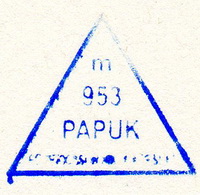
Mountaineer stamp Papuk 953m is fixed on the fence gate of military facility, so Zagy put blue ink on it and we had to try out if the stamp will be clearly visible. So I tried it in my little book in which I keep track of found caches. I pressed it on the fence, and got my stamp.
Our goal wasn't just to get to the highest point of Papuk, but to place a geocache for others, that aren't mountaineers, could visit this peak. The guard told us that we can pass by the fence of military facility and get to so called Little Papuk. There is visible path because we weren't the first that wanted to see the view from the top. And when we came there, we really had a beautiful view to south towards Požega valley.
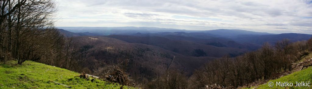
We spent half an hour on the top eating and drinking and enjoying probably one of the best views in Slavonija. For those a bit braver there is, so called, zen bench closer to the steep mountain slope. Actually, it is hard to describe the feeling that you have when you are at the top and just resting and breathing that fresh air, enjoying the sun and the view. So it is best for you to go there yourself. ![]() And now you also have a hidden geocache Papuk in the near vicinity that can only enrich whole experience.
And now you also have a hidden geocache Papuk in the near vicinity that can only enrich whole experience.
Walking back from peak Papuk we decided to turn to probably the hardest climb that day, the peak of Ivačka glava at 913 m altitude. Although it is the lower peak, it was harder to get there because of very steep climb.
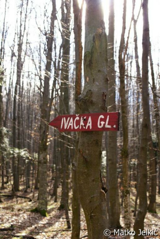
Walking the path we followed the markings mandatory, which were clearly visible this time, because we weren't on the dirt road anymore but in the woods. Zagy told me that he placed a geocache Mordor in the vicinity when he was here with the mountaineers on New Years Eve event. Geocache hasn't been found since so I was FTF, and we checked the cache that way if everything was ok with it. Zagy cleverly picked the name of geocache Mordor because on the cache spot you are surrounded with dark pine tree forest and it relay reminders you at the dark place from that Lord of the rings movie. Now the climb became steeper and for someone like me it wasn't hard at all. ![]()
If we forget, for a second, climbing over slick and steep terrain, it was really worth the effort to come to peak Ivačka glava because this time the view goes endlessly, but to the north towards Slatina. And beside that, there is a geocache hidden on the top, so we quickly forgot the pain in our feet. ![]() And just when we wanted to sit and relax a bit at the bench on the top, two young boys came here from Požega. We introduced ourselves and started to talk where are we from. Through talking we managed to explain them what brought us here from far away - geocaching. We gave them a bit of information about this activity, and we are hopping that we could interest them into it so that they could try it for themself. Who knows, maybe this duo will show us hidden beauties of surrounding cities and nature.
And just when we wanted to sit and relax a bit at the bench on the top, two young boys came here from Požega. We introduced ourselves and started to talk where are we from. Through talking we managed to explain them what brought us here from far away - geocaching. We gave them a bit of information about this activity, and we are hopping that we could interest them into it so that they could try it for themself. Who knows, maybe this duo will show us hidden beauties of surrounding cities and nature.

While we were talking three more guys came from Slatina and suddenly it was crowded at the top. ![]() We introduced ourselves and had a short chat, but we had to move along if we wanted to get to the next peak Nevoljaš before the sunset. It was really easy to come here, because there was just about 20 min light walk from our car. Nevoljaš is the lowest peak of the day and it is only at 740 m altitude, but the hidden geocache and the view were more than enough reason to visit.
We introduced ourselves and had a short chat, but we had to move along if we wanted to get to the next peak Nevoljaš before the sunset. It was really easy to come here, because there was just about 20 min light walk from our car. Nevoljaš is the lowest peak of the day and it is only at 740 m altitude, but the hidden geocache and the view were more than enough reason to visit.
Returning from Nevoljaš I found the last hidden geocache of that day at the pass Anđina baraka.
And driving home wasn't just driving because Zagy decided to put a geocache in village Kaptol at their medieval city Kaštel. More about this city you can read from this two info boards:
- info board part 1.
- info board part 2.
And to close this story, my wife Maja made delicious pancakes with chocolate cream and sliced bananas for us two exhausted geocachers and mountaineers, so a big thanks to her. ![]() And who knows, come with us next time and maybe there will be an extra pancake for you too.
And who knows, come with us next time and maybe there will be an extra pancake for you too. ![]()
Text written:


